StP122 Barfleur
STP · K.V.U.Gruppe Barfleur · AOK 7 Normandy · France

StP122 Barfleur rive gauche du port
Barfleur, probably my favorite port.
Even small ports were important to the war effort. Coasters constantly plied along the Normandy coast, supplying the German occupation forces. Ammunition, food, building materials in fact anything that needed transporting from say Cherbourg, Barfleur, St Vaast, Carentan, Isigny, Grandcamp, Courseulles, etc.
If the tide was right, an E-Boat could nip in and shelter. Fishing boats under the eyes of the German forces, would have armed guards on the board or an armed fishing trawler converted to (protect) the fishing fleet, (keep an eye on them). But really to stop them escaping to England. Which they did do.
There were also locals that spied on the enemy. They used Pigeons, radios, even contacts between fishing boats and clandestine British small boats. That plied across the channel and went as far as to Brittany. The French resistance movement was asked specifically not to antagonise
the enemy around the proposed landing areas. Better to have live spies, than dead heroes. Their information about troop movements, defence sites, radars, etc, was essential.
German forces thought Barfleur was to be a target for Allied forces in the event of an invasion and it was well defended by StP121 and StP122 .
There was also an anti submarine net across the harbour.
StP122 Barfleur rive gauche du port
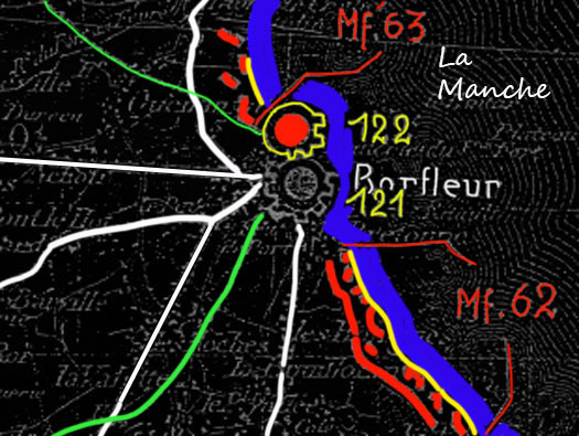
The north or left side of the harbour. There was a French defence called "The Batterie". This was a large large earth bank covering the seaward side. In this large mound two Tobruk's were built, one may have been a mortar. A fire control post (PDT). This PDT looks like it had a steel cupola? or was a concrete 'Pilz'. There was a second smaller PDT which may have been a small Luftwaffe detachment to keep an eye out for aircraft intruding in the area.
Included in the Batterie were two more Tobruk's, an Abri. A concrete shelter probably a Vf2 type shelter and a field gun.
The German record says 2 x Vf58c & 2 x Unterstands. I have been shown one surviving Tobruk and that is set into the entrance of the house on the harbour side. There may be another at the rear? The earth bank has now been completely removed.
An anti submarine defence was placed across the entrance, probably not to keep out a submarine, but to stop fast patrol boats and maybe under water divers that could mine shipping in the harbour?

StP122 Barfleur rive gauche du port
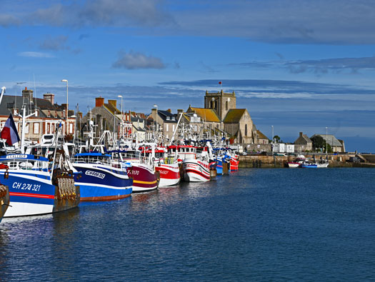
Barfleur harbour in October 2024, flags and pendants flying as it was a special day for the fishermen.
The Batterie is beyond the church.
StP122 Barfleur rive gauche du port
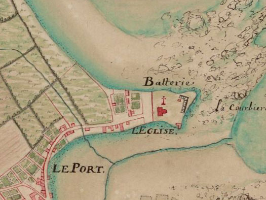
An early map showing the town (Le Port) the Church and the Batterie.
StP122 Barfleur rive gauche du port
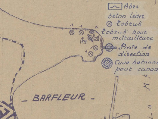
SHM Plan states:
1 - 4 x Tobruks.
2 - 1 x Cuve betone pour canon.
3 - 1 x Poste de direction.
4 - 1 x Poste de direction.
2 - 1 x Cuve. (Cuve translated - tank or possibly underground room a Vf2 type shelter).

StP122 Barfleur rive gauche du port

A better SHM plan of the batterie.
SHM
StP122 Barfleur rive gauche du port
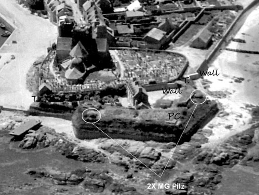
A really good picture of the old batterie wall with two 'Pilz' either end, a P.C. in the centre, a wall covering the rear access.
StP122 Barfleur rive gauche du port
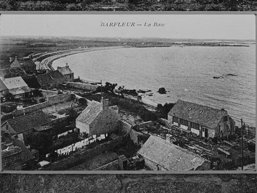
A view from the church tower over the back towards the Gatteville light house, ©1900.
StP122 Barfleur rive gauche du port

An Allied air photo, may have been taken post war, showing the old railway and the batterie still complete.
NARA
StP122 Barfleur rive gauche du port
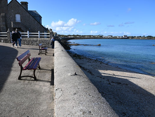
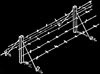
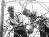
Barbed wire steel screw picket posts set int the wall, there were millions of these left over from WW1 and could have been collected by the Germans from French stores or direct off the old battlefields.
StP122 Barfleur rive gauche du port

Cut off stump
25 October 2024
StP122 Barfleur rive gauche du port
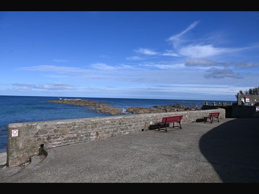

The wall.
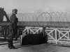
StP122 Barfleur rive gauche du port
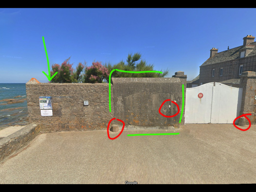

Green arrow, behind the wall was/is a Tobruk.
Left red circle, an old French military boundary stone.
Centre red circle, bullet marks.
Right red circle, a stone to stop carriage wheels damaging the gate post.
Green square - Strengthened wall.
The gate was at one time double the width and when the Germans started to defend the area, this wall was built to to make the entrance smaller. The small picture seems to show the gate fully closed off with a new wall.
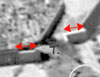
StP122 Barfleur rive gauche du port
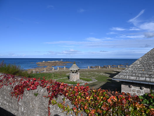

Now the garden of the large house.
StP122 Barfleur rive gauche du port
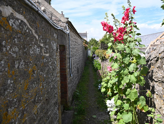
Passage. This runs along the back of the Batterie.
StP122 Barfleur rive gauche du port
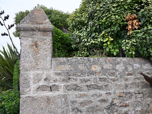

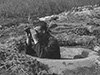
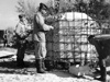
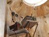
The second entrance to the Batterie and behind the wall a Tobruk.
StP122 Barfleur rive gauche du port
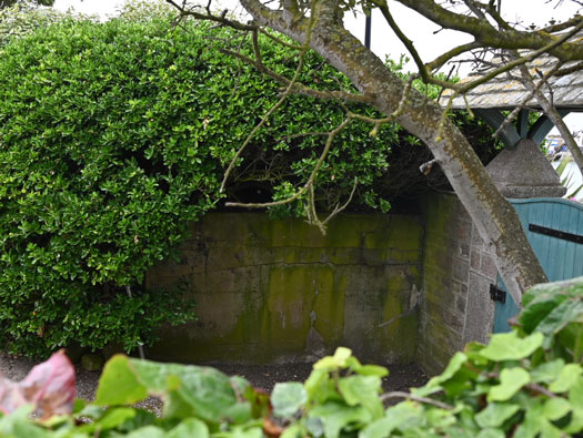
This is inside looking over the wall at the Tobruk.
StP122 Barfleur rive gauche du port
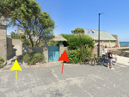
Yellow - Passage.
Red - The site of the Tobruk.
The more modern life boat station, late 50's/60's, was not there in the war and there was a clear view from the batteries outer wall.
StP122 Barfleur rive gauche du port
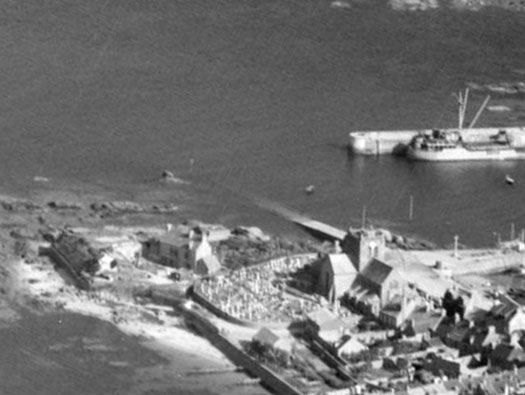
Looking down on the Batterie and church,
StP122 Barfleur rive gauche du port
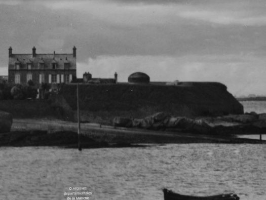

This picture showing the house and then the observation dome.
StP122 Barfleur rive gauche du port
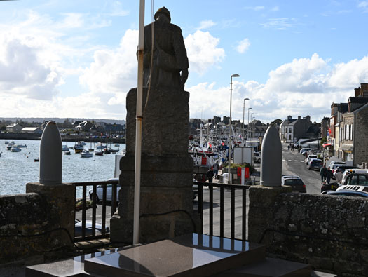
The Churchyard with the WW1 war memorial, I am sure a machine gun could have been set up here, in times of need, to cover the inner port.
StP122 Barfleur rive gauche du port
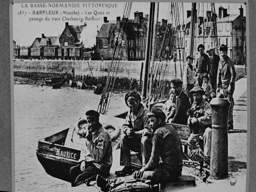

Maybe some of the fishermen in this picture were then older men in the occupation.
StP122 Barfleur rive gauche du port
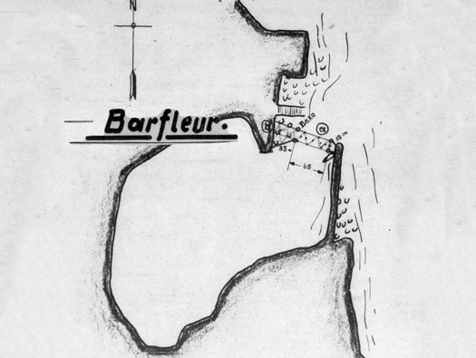

A nice plan from a NARA document showing the anti submarine net that covered the entrance.
Written on the plan was:
"Between the west bank and the beacon 14, a horizontal net. From the beacon east pier 65m horizontal, 35m wide, 10m passage gap, can be closed by double rope barrier". (translated from the German text).
NARA T-1022 2255 --- NARA T-1022 2255
StP122 Barfleur rive gauche du port
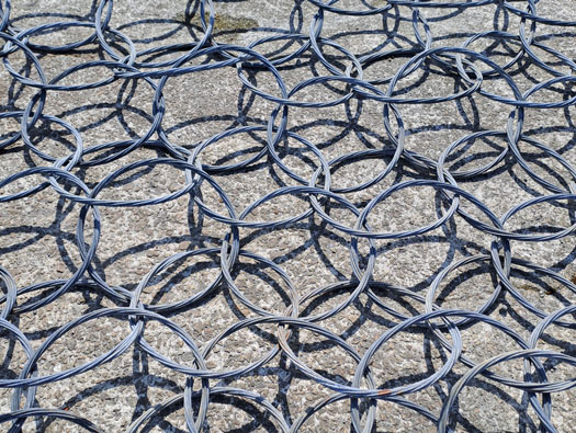
A British anti submarine net from Scapa Flow, Scotland.
StP122 Barfleur rive gauche du port
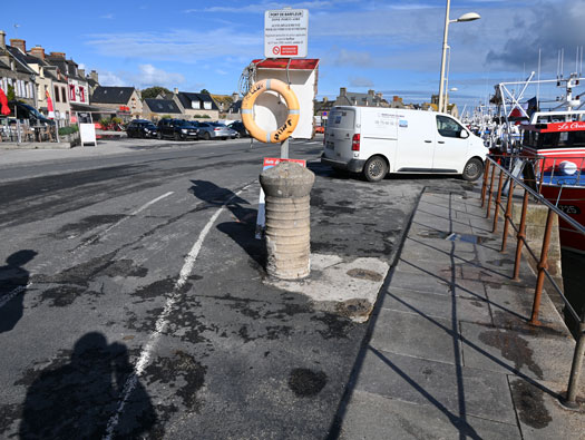

A concrete bollard to tie up fishing boats. Possibly the original was damaged and the American Engineers helping to clear the port added their names in the concrete.
StP122 Barfleur rive gauche du port
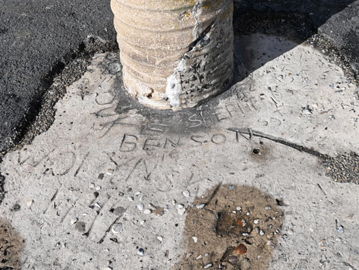

Benson, Shepherd, Duk, Sgt ?, Wolynski and other. These are the names of probably US Engineers who came to clear the port of mines, damages and sunk shipping blocking the harbour and also replaced a bollard with their own designed one and left their names in the then, wet concrete.
StP122 Barfleur rive gauche du port