Wn11 Ouistreham-Le Maresquire (Sword Beach)
K.V.Gruppe River-Bella (Sword & Juno Beaches) · AOK 7 Normandy · France

Wn11 Ouistreham-Le Maresquire
Bigot map showing the defence inside a quarry which is a very good defence position.
South of it there were petrol tanks which are still used today.
BIGOT map


Wn11 Ouistreham-Le Maresquire
Google Maps
Wn11 Ouistreham-Le Maresquire
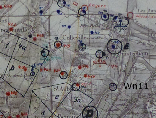
German artillery fire control map showing Wn's and batterie sites. Wn11 set on the side of the canal between Ouistreham and Benouville and Pegasus Bridge.
NA


Wn11 Ouistreham-Le Maresquire
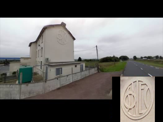
I do not know what the sign is, I thought when I first saw it that it was SNCF railways but I am not too sure now. It was fuel depot in 1944.
2011Google