|
|
|
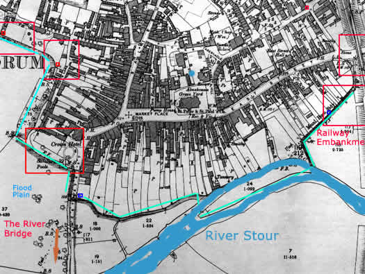
INFORMATION: Map of Blandford South with the Railway on its left flank, the River Stour to its Front and a flood plain to its right flank. This is the original old Medieval center of the town. The
defense ran from the Railway Embankment, along the River to the
old Dorchester road and Medieval Bridge. Around to the Crown Hotel
with its strengthened wall and then an antitank ditch running all
the way around the western flank. |
| Map
of Blandford
> Southern Map |
The Defence of Blandford Forum 1940 |