Wn162 La Parnelle ´Luftwaffe´ station 'Bernhard'
K.V.U.Gruppe Barfleur · AOK 7 Normandy · France

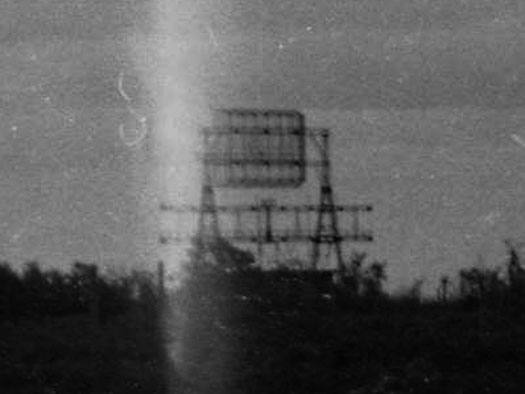
Luftwaffe Station B07.
1 x SK/Machinenstand.
1 x 'Bernhard' FusAn 724/725 Telefunken.
'Bernhard' FusAn 724/725 was a German radio navigation system developed by Telefunken to enable an aircraft to identify its position by radio signals.
The system was started in the autumn 1941 and comprised an antenna 22 metres in diameter which rotated twice a minute. Each station broadcast a unique radio signal and with only two of these, the individual aircraft could get a very precise position.
For its time, it was remarkably sophisticated and proof against Allied electronic jamming.
The receiver in the aircraft (FuG 120 "Bernhardine") displayed the bearing from the station on a printed out narrow paper strip.
The Germans erected transmitters, 300 km apart, across occupied Europe and the system continued to be develop and expanded throughout the war.
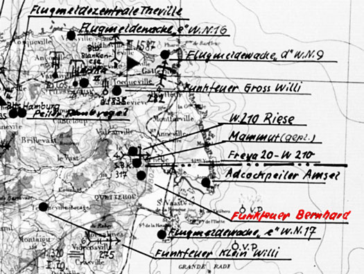
Plan of the N/E coast of the Cotentin showing Wn162 Funkfeuer Bernhard.
Funkfeuer - Radio Beacon.
Jägerführung - Fighter Control.
Bernhard - Émetteur code name.
Bernardine - the aircrafts receiver.
FuSAN - (often written as FuS An) stands for Funk-Sende-Anlage, which translates to Radio Transmitting Installation or Radio Broadcasting Station.
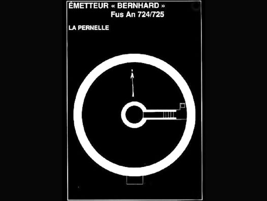
This is where the rails went to hold the émetteur, I believe there are a row of bolts sticking up to gold down the ring.
In the centre was the motor to turn the émetteur, powered by either mains power or a generator. The circle was a railway style track that the four large bogies moved on.
Plan.
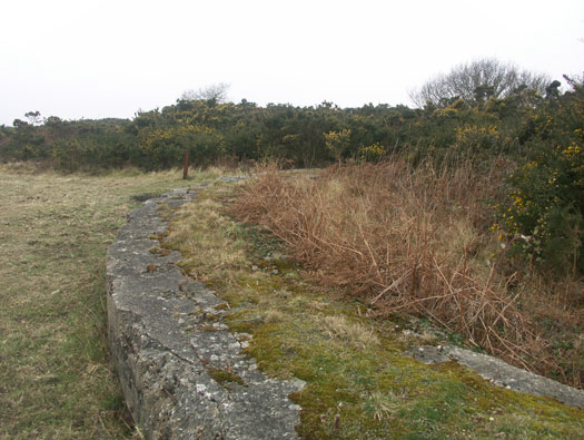
This is where the rails went to hold the émetteur, I believe there are a row of bolts sticking up to gold down the ring.
20 March 2006
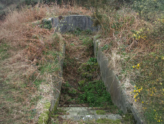
Access to the pit where the motor would have sat.
20 March 2006
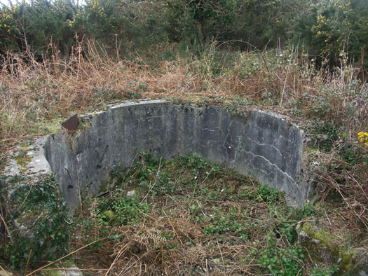
This is possibly where the motor sat.
20 March 2006
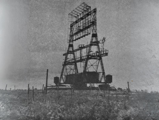
Another post capture photo taken by British observers and the damage can be seen to the antenna.
DEFE 2/488
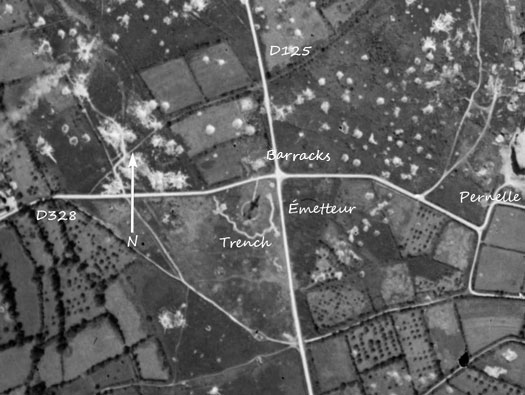
A 1947 air photo showing the émetteur, the trench defence and the barrack building. Also the bombing of the area in June 1944 and earlier.
IGNF 1947
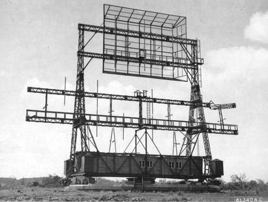
It rotated on four large bogies either side and a spindle in the middle. A long wooden cabin was the control room of the unit. This picture was post capture and you can see damage done to its right side.
61340A.C.
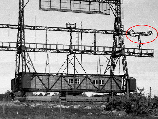
Battle damage and the wooden cabin running its full length.
É
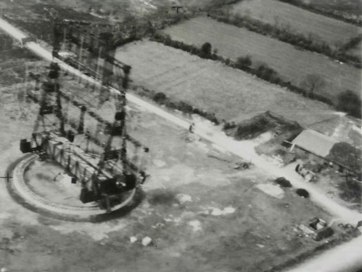
Low level reconnaissance photo.
The commune of La Pernelle was heavily fortified by the Germans during the Occupation. Due to its elevation above sea level—ranging between 89 and 110 meters—the site served as an exceptional observation post for defending the Val de Saire coastline. Consequently, all three branches of the German military undertook the construction of various structures there throughout the war. The Luftwaffe, was the first to establish a presence: an imposing "Bernhard" FuSAN 724/725 transmitter was erected in 1941. Originally codenamed "B07," this station was effectively linked to the Widerstandsnest (resistance nest) designated as Wn.162. The primary function of this powerful radio-navigation system was to guide German aircraft during raids on Great Britain. Although the equipment was scrapped after the war, the concrete base and the circular track that allowed for 360-degree rotation still remain; these elements are, in fact, in very good condition. A structure to house a power generator was also built to supply energy to the transmitter, though its exact location can no longer be determined. Wooden barracks for the operators were reportedly constructed nearby as well, but no visible traces of them remain today.
(Université de Caen Normandie).
Another good radar website is - https://www.gyges.dk/Flum%20and%20Jagd.htm
Reconnaissance Photo